


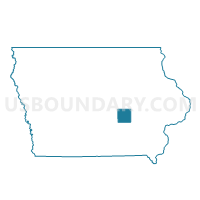
PLEASANT TWP Voting District, Poweshiek County, Iowa
About
Outline

Summary
| Unique Area Identifier | 583303 |
| Name | PLEASANT TWP Voting District |
| County | Poweshiek County |
| State | Iowa |
| Area (square miles) | 36.01 |
| Land Area (square miles) | 35.98 |
| Water Area (square miles) | 0.03 |
| % of Land Area | 99.93 |
| % of Water Area | 0.07 |
| Latitude of the Internal Point | 41.63828970 |
| Longtitude of the Internal Point | -92.60061760 |
Maps


Graphs
Select a template below for downloading or customizing gragh for PLEASANT TWP Voting District, Poweshiek County, Iowa


Neighbors
Neighoring Voting District (by Name) Neighboring Voting District on the Map
- BEAR CREEK TWP Voting District, Poweshiek County, IA
- GRANT TWP W/GRINNELL Voting District, Poweshiek County, IA
- JACKSON TWP W/O BARNES CITY Voting District, Poweshiek County, IA
- MALCOM TWP Voting District, Poweshiek County, IA
- SCOTT TWP Voting District, Poweshiek County, IA
- SUGAR CREEK TWP Voting District, Poweshiek County, IA
- UNION TWP Voting District, Poweshiek County, IA
- WASHINGTON TWP Voting District, Poweshiek County, IA
Top 10 Neighboring County Subdivision (by Population) Neighboring County Subdivision on the Map
- Jackson township, Poweshiek County, IA (1,838)
- Bear Creek township, Poweshiek County, IA (1,820)
- Union township, Poweshiek County, IA (837)
- Malcom township, Poweshiek County, IA (580)
- Grant township, Poweshiek County, IA (522)
- Washington township, Poweshiek County, IA (451)
- Sugar Creek township, Poweshiek County, IA (434)
- Pleasant township, Poweshiek County, IA (289)
- Scott township, Poweshiek County, IA (257)
Top 10 Neighboring Unified School District (by Population) Neighboring Unified School District on the Map
- Grinnell-Newburg Community School District, IA (12,151)
- Montezuma Community School District, IA (3,499)
- Brooklyn-Guernsey-Malcom Community School District, IA (3,347)
- Lynnville-Sully Community School District, IA (2,846)